


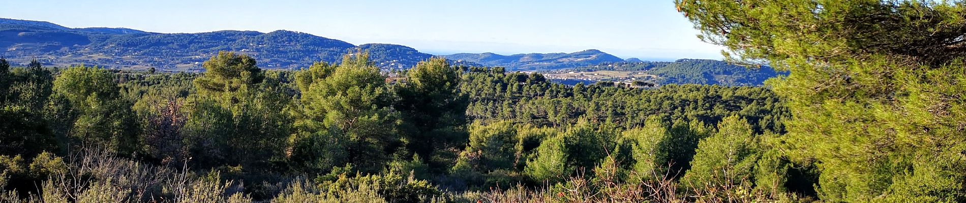
le beausset abime de Maramouyé

bernir
User
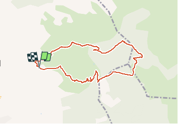

Length
9.6 km

Max alt
522 m

Uphill gradient
285 m
Km-Effort
13.4 km

Min alt
281 m

Downhill gradient
287 m
Boucle
Yes
Creation date :
2021-01-14 08:36:27.429
Updated on :
2021-01-14 16:58:50.254
4h32
Difficulty : Very easy

FREE GPS app for hiking
 SityTrail
IGN / Geographical institutes
SityTrail Plus
The world is yours!
About
Trail Walking of 9.6 km to be discovered at Provence-Alpes-Côte d'Azur, Var, Le Beausset. This trail is proposed by bernir.
Photos


Positioning
Country:
France
Region :
Provence-Alpes-Côte d'Azur
Department/Province :
Var
Municipality :
Le Beausset
Location:
Unknown
Start:(Dec)
Start:(UTM)
729711 ; 4789221 (31T) N.
Comments
superq